Post
London Living Streets Walking Map
28 Sep 2020
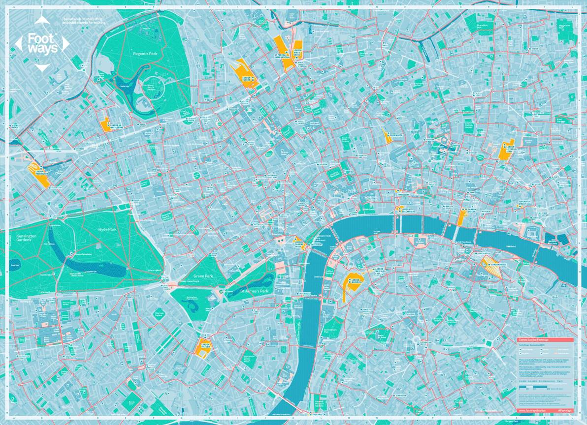
In June this year, Emma Griffin and David Harrison of London Living Streets talked to the Society about the Central London Footways, utilitarian walking routes along streets with less motor traffic and pollution.
With the support of Transport for London (TfL) a beautifully illustrated map of these 'footways' is now available for free at several central London locations, which can be found online at www.footways.london alongside more information about the network (you can also order it online). The printed map and design concept - developed by Urban Good - provides a wealth of information about walking in the capital and will support Londoners and visitors to walk longer distances on everyday trips.
Central London Footways highlights an extensive number of routes across the city, serving as a reminder that many 20- or 30-minute walks across central London take just a few minutes longer than a journey on public transport. The network of routes connects London's mainline railway stations, popular destinations and green spaces using the capital's most appealing and accessible streets. The printed map is the culmination of an 18-month project led by David, Emma and other volunteers at London Living Streets, who have walked extensively across London with residents, businesses, cultural organisations, councillors and local campaigners to find opportunities for safe and attractive walking routes.